|
(Image: Example of a borehole legend for boring in soil by continious extraction of cores to DIN 4022 Part 3 [FI-Spang]) Boring or drilling permits exploration in soil and rock up to great depths. Its execution is also not much hindered by groundwater [DIN4021]. Depending on the type of soil, various methods are used (rotary, dry core, dynamic core or pressure core drilling) in order to remove the soil. The DIN 4021 provides an overview of the application … |
|
(Image: Exploration and investigation methods within the scope of geotechnical investigations) "Direct exploration is exploratory work done at natural or man-made exploration points which permits the ground (remark: subsoil) to be visually examined, soil and rocks to be sampled and field testing to be carried out" [DIN4020:2003] [DIN4020:2003]. In the direct exploration method, information can be gathered on strata or bedding joints, types of rock … |
|
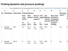
(Table: Types and Application areas of probing apparatuses to DIN 4094 [DIN4094-1] [DIN4094-2a] [DIN4094-4] [DIN4094-5]) According to DIN 4094 [DIN4094-1:2002] [DIN4094-2:2002] [DIN4094-4:2002] [DIN4094-5], the term probing, also called sounding or penetration test, is defined as, an indirect subsoil exploration method in soils by means of usually vertical penetration of a probe with measurement of characteristic values of penetration resistance. One … |
|
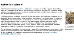
(Image: Example of the execution of reflexion seismic for groundwater search [FI-DMTb]) In reflexion seismic (Bild 4.5.2.2.2.1.1), the waves created at the surface and reflected from contrasting surfaces below ground are received at short distances from the source (relative to the target depth). The data received from the multi-channel telemetric apparatus, usually very comprehensive, can be processed and presented by special computer methods in such … |
|
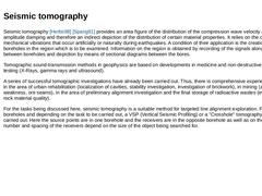
(Image: Example of the execution of refraction seismic for contaminated soil exploration [FI-DMTb]) With refraction seismic (Bild 4.5.2.2.2.1.2), the waves are received at a greater distance from the source (relative to target depth). This means that, besides the reflexion from the subsoil, waves are also recorded that have used the fastest route between source and receiver and thus show the first returns of the seismic signals. Computer programs have … |
|
Seismic tomography [Herbs98] [Spang91] provides an area figure of the distribution of the compression wave velocity and the amplitude damping and therefore an indirect depiction of the distribution of certain material properties. It relies on the observation of mechanical vibrations that occur artificially or naturally during earthquakes. A condition of their application is the creation of boreholes in the region which is to be examined. Information … |
|
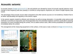
In acoustic seismic (Bild 4.5.2.2.2.1.4), the soil particles are vibrated by means of acoustic signals (airborne sound), which change in their frequency with time (sweep), in contrast to using impacts, explosives, etc. where a single impulse creates the seismic waves. The advantage of the acoustic source when compared to the other seismic sources is in its handiness, freedom from destruction and its better reproducibility and regularity of the seismic … |
|
Seismic is by far the most important and widespread method of geophysical exploration used for searching for deposits (oil, gas, coal) and also provides important structural information for the engineering and environmental fields. In the seismic method, elastic waves and wave fields are used as the information carriers and these can be processed to provide figures of the underground. This permits a direct view of its complex structure. |
|
(Image: Physical measurement principle of magnetism [Lenz97]) The earth's magnetic field is very strongly influenced on the surface by the upper layers or strata of the underground. In the region in which engineering geophysics occurs, these are not the layers themselves but the structures contained in them such as iron components, bunkers, tanks, beams, pipelines, waste, barrels and reinforced concrete foundations. Often, these iron components are … |

|
In the process of Electromagnetic Induction (EMI), the subsoil is subjected to an alternating field by means of a coil and this induces a secondary field. This, again, superimposes itself on the exciting field. The resulting field is measured by a receiver coil. The frequency range used in the EMI method ranges from 10 Hz to 2 MHz. The coil spacings vary from a few metres to about 100 m. Electromagnetic methods react very sensitively to zones of enhanced … |
|
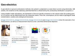
In geo-electric or ground conductance methods, the subsoil is subjected to a weak direct current using electrodes. With the aid of sondes, the existence of the stationary potential field that is influenced by the conductivity distribution is acquired. U Using suitable model calculations, the distribution of the true specific resistance in the subsoil under the probing point, along a profile or in a section can be determined from the measured values. … |
|
|
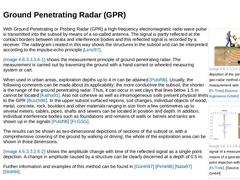
(Image: Schematic depiction of the principle of the geo-radar method of measurement with reference to [FI-Trote] [Image: S&P GmbH])
|
|
(Image: Reflected signal of a measurement by means of a georadar in a single point depiction with reference to [FI-Trote])
|
With Ground Penetrating or Probing Radar (GPR) a high-frequency electromagnetic radio wave pulse is transmitted into the subsoil by means of a so-called antenna. The signal is partly reflected … |
|
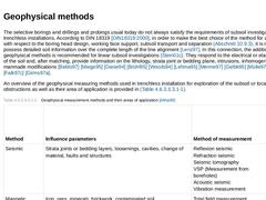
The selective borings and drillings and probings usual today do not always satisfy the requirements of subsoil investigation for trenchless installations. According to DIN 18319 [DIN18319:2000], in order to make the best choice of the method for an application with respect to the boring head design, working face support, subsoil transport and separation (Abschnitt 10.9.3), it is necessary to possess detailed soil information over the complete length … |
|
"Indirect exploration involves geophysical methods and techniques (e.g. soundings) used to determine the physical properties of soil and rock which, when correlated with geotechnical parameters, allow conclusions to be drawn regarding the ground (remark: subsoil) conditions" [DIN4020:2003] [DIN4020:2003]. Among the indirect exploration methods are: - Probings (dynamic and pressure probings) (Abschnitt 4.5.2.2.1) ;
- Geophysical methods (Abschnitt 4.5.2.2.2).
|
|
|
(Image: Seismic pre-exploration from the shield machine with the SSP system in soil [FI-Herreb] - Sketch of the principle and method of functioning)
|
|
(Image: Seismic pre-exploration from the shield machine with the SSP system in soil [FI-Herreb] - Sensors installed into the boring head)
|
|
(Image: Seismic pre-exploration from the shield machine with the SSP system in soil [FI-Herreb] - Processed graphic with cobbles or boulders intruded in the subsoil)
|
|
|
Which exploration and investigation methods are to be used in a particular application case should be subject to consultation between an experienced engineer with detailed knowledge of trenchless installations and an expert on local soil conditions ("geotechnical specialist" [DIN4020:2003] [DIN4020:2003]) before specifying geotechnical investigations for a trenchless project. The investigation of the subsoil is not subject to any whim of the geotechnical … |
|
(Image: Geologic cross section through the bank [Zezsc99]) For pipe jacking underneath a mining railway embankment, exploration by means of probings were carried out on both sides of the embankment. According to this investigation, cohesive soil was to be expected in the jacking region. The groundwater level was below the base levels of the start and target shafts. During jacking, after approximately 30 m, coarse gravel with a large proportion of … |
|
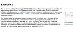
(Image: Geologic cross section through the railway embankment [Zezsc99]) The un-steered jacking of a steel pipe DN/ID 500 by means of auger boring was to be carried out for a wastewater sewer under a double tracked railway line. The jacking was in natural friable and cohesive soils. Because of the insufficient water retention measures and because of the unexpected cutting of a flat dipping strata (Bild 4.5.2.5.1.2), the jacking was carried out with … |
|
In the following, two examples (Abschnitt 4.5.2.5.1.1) (Abschnitt 4.5.2.5.1.2) of trenchless installation by jacking [Zezsc99] will be given to demonstrate the difficulties in the interpretation of exploration results with reference to the subsoil. The examples show that sometimes, despite adherence to the exploration requirements to DIN 4020 [DIN4020:2003] [DIN4020:2003], unforeseen difficulties can crop up. |
|
The results of the geotechnical investigation as well as the laboratory analyses must be determined accurately by the geotechnical specialist and described in a geotechnical report. According to DIN 4020 [DIN4020:2003] [DIN4020:2003], the geotechnical report comprises the presentation and evaluation of the results of all geotechnical investigations and the conclusions to be drawn with regard to the project and the construction work, and is meant to … |
|
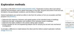
(Image: Exploration and investigation methods within the scope of geotechnical investigations) According to DIN 4020 [DIN4020:2003] [DIN4020:2003], "Exploration involves direct and indirect methods and techniques used to obtain information on the type, structure and extent of soil and rock formations, the groundwater conditions, and the effects of seepage." Subsoil explorations are carried out either in-situ from the surface or from an excavation and … |
|
According to DIN 4020 [DIN4020:2003] [DIN4020:2003], geotechnical investigations, "are the methods and techniques employed in engineering geology, hydrogeology, hydrology, geophysics and soil and rock mechanics in order to describe and assess soil and rock for civil engineering purposes." The investigations include field as well as laboratory tests. The aim of geotechnical investigations, which are also known commonly as subsoil or site investigations |
|
|
|

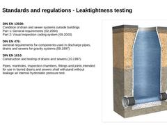
Standards and regulations |
|

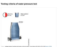
| (Image: Leakage testing of manholes with water as the test medium - test criteria to EN 1610 / ATV-A 139) |
|